Kaggle Airline Delay & Cancellation Analysis (SQL)
Analysis of Domestic Airline Cancellation and Delays (2009-2018)
| Home |
|---|
| Motivation |
| About the Data |
| Obtaining Data |
| Software Requirements |
| Analysis with SQL |
| Summary |
| Glossary |
| References |
About the Data:
An amalgamation of 2 datasets have been used to generate the insights.
- The main dataset has been sourced from Kaggle. Overall, the main dataset was nearly 7 GB in size with nearly 68 million rows.
- An additional dataset with the metadata for Global Aiports has been fetched from Partow. Only relevant information will be provided for the latter due to lesser importance.
Fields Descripton
-
Airline Cancellation/Delay (2009-2018) dataset
| Name | Description | Type(Format) | Example |
|---|---|---|---|
| FL_DATE | Date of the flight | DATE (yy/mm/dd) | 2009-05-02 |
| OP_CARRIER | Airline Identifier | STRING | 9E |
| OP_CARRIER_FL_NUM | Flight Number | INTEGER | 2216 |
| ORIGIN | Starting Airport Code (IATA Code) | STRING | MLI |
| DEST | Destination Airport Code (IATA Code) | STRING | MEM |
| CRS_DEP_TIME | Planned Departure Time | INTEGER | 600 |
| DEP_TIME | Actual Departure Time | FLOAT | 603.0 |
| DEP_DELAY | Total Delay on Departure in minutes | FLOAT | 3.0 |
| TAXI_OUT | The time duration elapsed between departure from the origin airport gate and wheels off | FLOAT | 14.0 |
| WHEELS_OFF | The time point that the aircraft’s wheels leave the ground | FLOAT | 617.0 |
| WHEELS_ON | The time point that the aircraft’s wheels touch on the ground | FLOAT | 757.0 |
| TAXI_IN | The time duration elapsed between wheels-on and gate arrival at the destination airport | FLOAT | 8.0 |
| CRS_ARR_TIME | Planned arrival time | INTEGER | 732 |
| ARR_TIME | Actual Arrival Time | FLOAT | 805.0 |
| ARR_DELAY | Total Delay on Arrival in minutes | FLOAT | 33.0 |
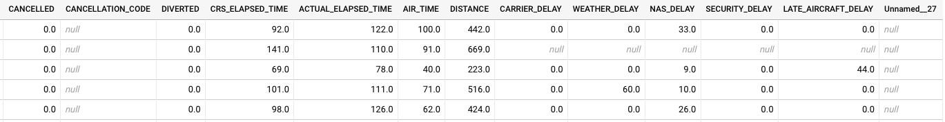
| CANCELLED | Flight Cancelled (1 = cancelled) | FLOAT | 0.0 |
| CANCELLATION_CODE | Reason for Cancellation of flight: A - Airline/Carrier; B - Weather; C - National Air System; D - Security | STRING | D |
| DIVERTED | Aircraft landed on airport that out of schedule | FLOAT | 0.0 |
| CRS_ELAPSED_TIME | Planned time amount needed for the flight trip | FLOAT | 92.0 |
| ACTUAL_ELAPSED_TIME | AIR_TIME+TAXI_IN+TAXI_OUT | FLOAT | 122.0 |
| AIR_TIME | The time duration between wheels_off and wheels_on time | FLOAT | 100.0 |
| DISTANCE | Distance between two airports | FLOAT | 442.0 |
| CARRIER_DELAY | Delay caused by the airline in minutes | FLOAT | 0.0 |
| WEATHER_DELAY | Delay caused by weather | FLOAT | 0.0 |
| NAS_DELAY | Delay caused by air system | FLOAT | 33.0 |
| SECURITY_DELAY | Delay caused by security | FLOAT | 0.0 |
| LATE_AIRCRAFT_DELAY | Delay caused by aircraft reaching late | STRING | 0.0 |
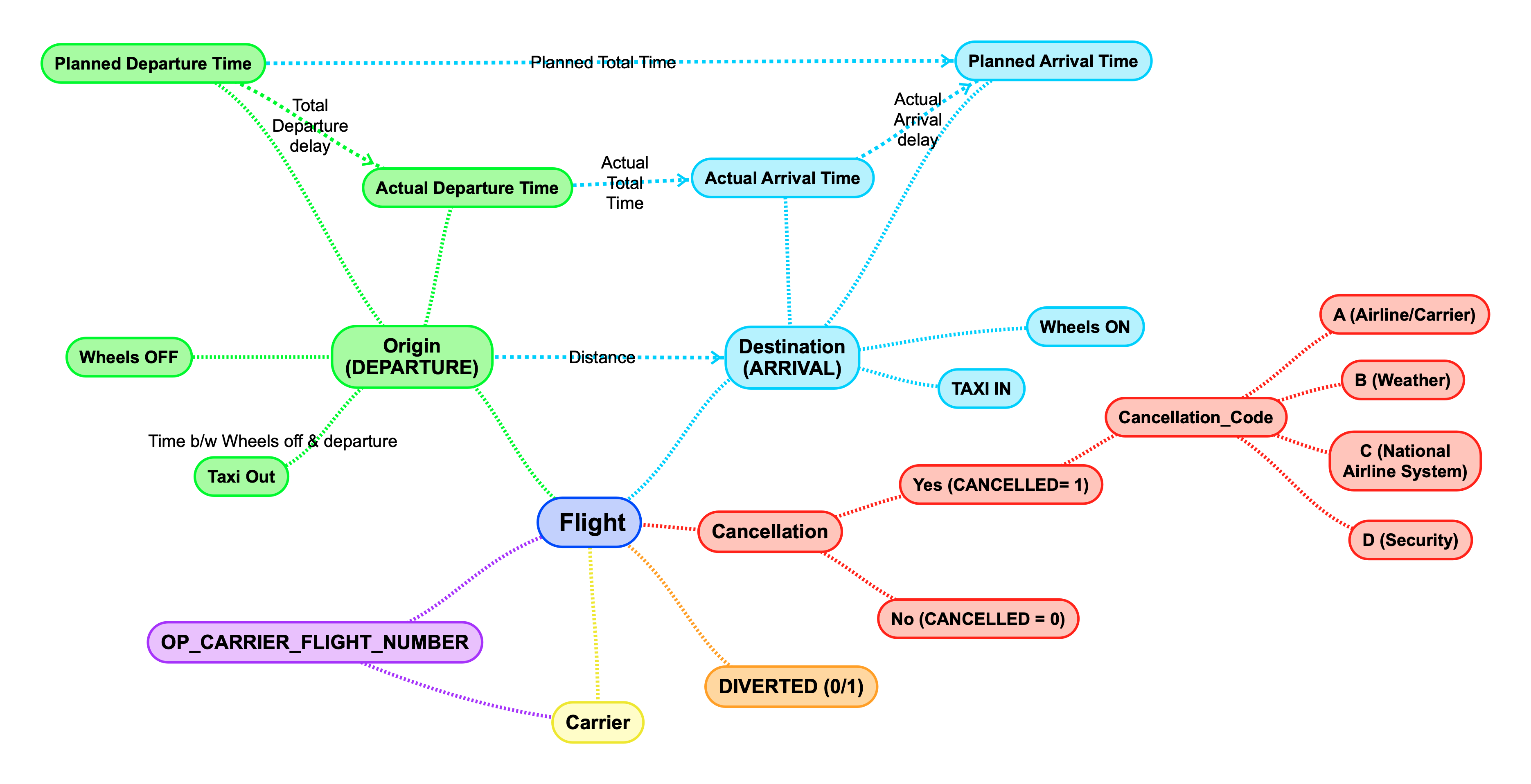
Fields Graph:
- The following shows the relation between columns:
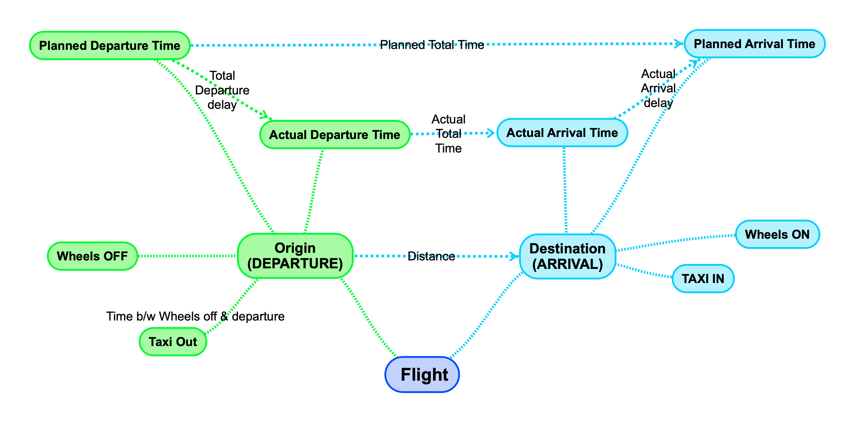
Complete Fields Graph
-
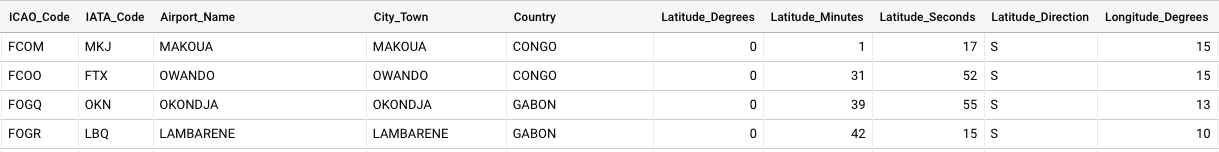
The Global Airport Database dataset:
| Name | Type | Example |
|---|---|---|
| ICAO Code | (3-4 chars, A - Z) | KATL |
| IATA Code | (3 chars, A - Z) | ATL |
| Airport Name | String | THE WILLIAM B HARTSFIELD ATLANTA INTERNATIONAL |
| City/Town | String | ATLANTA |
| Country | String | USA |
| Latitude Degrees | Integer [0,360] | 33 |
| Latitude Minutes | Integer [0,60] | 38 |
| Latitude Seconds | Integer [0,60] | 25 |
| Latitude Direction | Char (N or S) | N |
| Longitude Degrees | Integer [0,360] | 84 |
| Longitude Minutes | Integer [0,60] | 25 |
| Longitude Seconds | Integer [0,60] | 37 |
| Longitude Direction | Char (E or W) | W |
| Altitude (Altitude in meters from mean sea level) | Integer [-99999,+99999] | 313 |
| Latitude Decimal Degrees | Floating point [-90,90] | 33.64 |
| Longitude Decimal Degrees | Floating point [-180,180] | -84.427 |
Fields Data Preview
Main Dataset
Set 1: 15/27 columns
Set 2: Remaining 12/27 columns
Auxillary Dataset